QUALITY CONTROL SERVICES
As-Built vs. Design Comparison
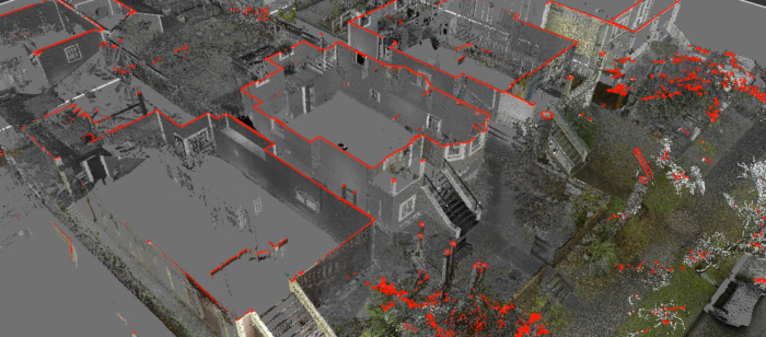
This is one of the most valuable QC applications. The surveyor scans a completed (or partially completed) structure and compares the resulting point cloud against the original BIM model or CAD drawings. Deviations — even sub-millimetre ones — are colour-mapped and reported, giving contractors and engineers a clear picture of where construction drifted from design intent. This is common in steel fabrication, precast concrete, MEP installations, and façade construction.
Structural Deformation Monitoring
By scanning a structure at multiple points in time — during loading, after settlement, or across seasons — a surveyor can detect and quantify deformation, tilt, bowing, deflection, or settlement. The point clouds are registered and differenced, making changes visible that would be impossible to detect with conventional instruments alone. This is widely used for bridges, retaining walls, tunnels, and high-rise buildings.
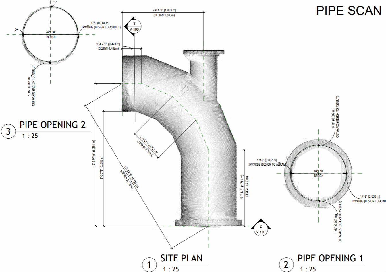
Dimensional Verification of Fabricated Components
Before components leave a fabrication yard — steel sections, precast panels, pipe spools — a surveyor can scan them and verify dimensions against engineering tolerances. Catching non-conformances at the yard is far cheaper than discovering them during on-site installation.
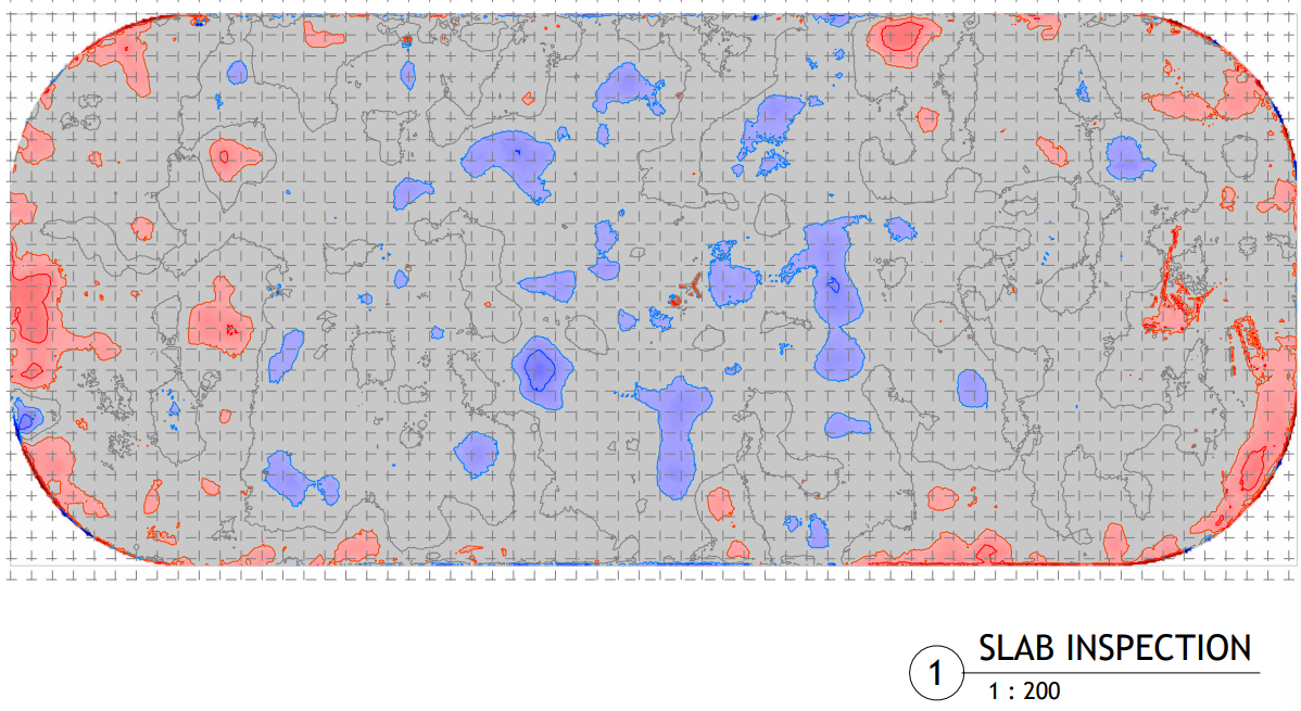
Floor Flatness & Levelness (FF/FL)
Scanning a concrete floor slab produces thousands of elevation measurements, from which FF/FL values (per ASTM E1155 or similar standards) can be calculated across the entire surface — not just along survey lines. This is far more comprehensive than traditional straightedge or dipstick methods and gives a spatial map of problem areas.
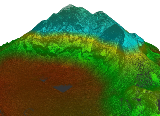
Volumetric Calculations (Stockpile & Earthworks QC)
Point clouds generated from scanning (or drone photogrammetry) allow accurate volumetric measurement of stockpiles, cut/fill earthworks, and excavations. This supports payment verification, mass-haul reconciliation, and compliance with earthworks specifications — replacing manual rod-and-level surveys with a much denser and more accurate dataset.

Tunnel & Underground Excavation Profiling
In tunnelling, the surveyor can scan the excavated profile and compare it against the theoretical design envelope. Overbreak (too much removed) and underbreak (insufficient excavation) are quantified and mapped, supporting payment and ensuring lining thickness will be adequate.