
SERVICES OVERVIEW
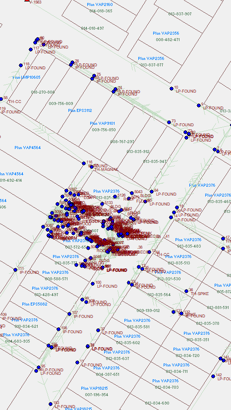
LEGAL SURVEYS
we understand that legal surveys are the foundation of secure property ownership and development. Our licensed surveyors deliver precise boundary surveys, subdivision plans, and title surveys that fully satisfy regulatory and legal requirements. With deep knowledge of BC land title legislation and local jurisdiction requirements, we bring the expertise needed to get it right the first time.
Our legal survey services cover everything from lot line adjustments and consolidations to strata plans and right-of-way definitions. We work closely with lawyers, notaries, developers, and landowners to ensure that every plan is accurate, compliant, and clearly documented. Our team manages the full process from field work through to Land Title Office submission, so you have one reliable point of contact throughout.
360 Surveys is committed to delivering legal survey services with the precision and professionalism your transaction or development requires. Whether you are resolving a boundary dispute, satisfying a condition of sale, or planning a subdivision, we guide you through the process with clarity and confidence. Contact us today to discuss your legal survey needs.
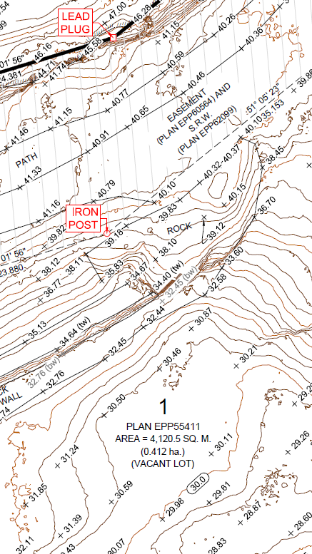
TOPOGRAPHIC SURVEYS
we provide detailed topographic surveys that give engineers, architects, and planners the accurate spatial information they need to move projects forward. Our field crews capture comprehensive surface data including terrain, drainage features, vegetation, utilities, and existing structures to produce reliable topographic maps and models. We understand that quality base data at the start of a project saves time and cost at every stage that follows.
Our topographic survey deliverables are tailored to your project requirements, whether you need traditional 2D CAD drawings, 3D surface models, or GIS-ready datasets. We work across a wide range of project types including residential developments, municipal infrastructure, environmental assessments, and industrial sites. Our team coordinates closely with your design professionals to ensure the data format and level of detail meet your exact specifications.
360 Surveys is dedicated to delivering topographic surveys that are thorough, accurate, and on schedule. We combine experienced field crews with advanced data processing to produce results you can rely on. Reach out today to discuss how we can support your next design or planning project.
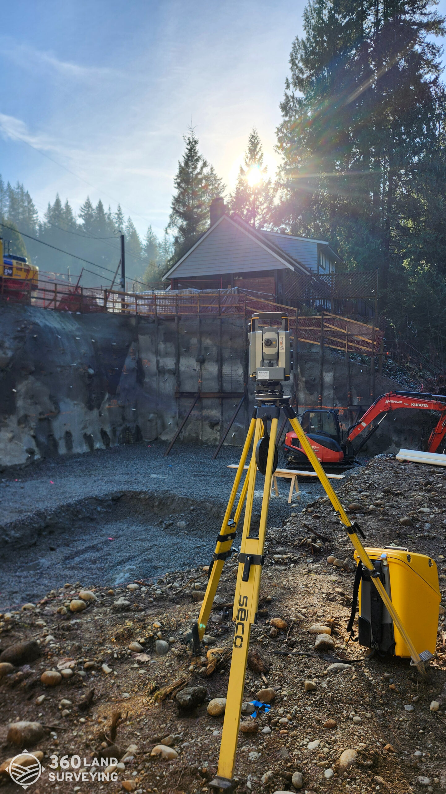
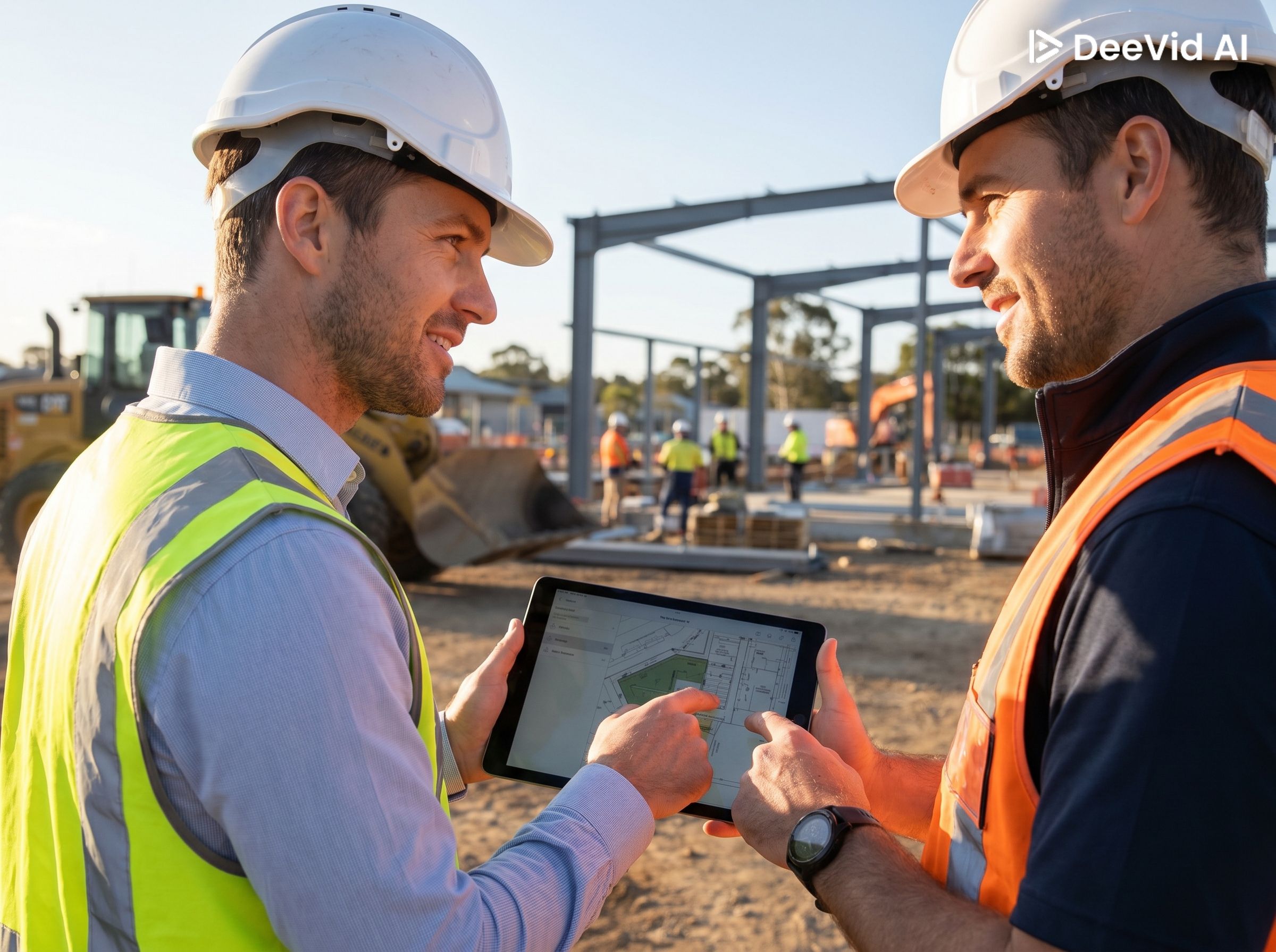
CONSTRUCTION SURVEYS
At 360 Surveys, construction surveying is at the core of what we do. Our experienced team delivers the precise, dependable survey support that keeps your project moving — from the first stake in the ground to final as-built documentation. We bring a thorough understanding of construction workflows across residential, commercial, and civil sectors, so we know what your project demands at every stage.
Our construction survey services span the full project lifecycle, including site preparation, layout and staking, grade control, and as-built surveys. We invest in advanced equipment and field technology to maximize accuracy and efficiency on every site. Our surveyors are trained in current best practices for data collection and reporting, giving your team the reliable information needed to build with confidence.
360 Surveys is committed to being a responsive, on-the-ground partner throughout your project. We pride ourselves on delivering accurate results on time, with the communication and professionalism your project deserves. Reach out today to discuss how we can support your next construction project.
QUALITY CONTROL
we offer independent quality control and verification services to ensure the accuracy and integrity of spatial data on your project. Our QA/QC programs are designed to provide owners, project managers, and contractors with an objective, third-party review of survey data and construction positioning before work proceeds. Catching errors early protects your project from costly corrections and schedule delays down the line.
Our quality control services include independent survey verification, data validation, as-built compliance checks, and construction tolerance assessments. We apply rigorous review processes and clearly documented reporting so your team has a transparent record of what was checked and confirmed. We are experienced working within the quality management frameworks of large civil, infrastructure, and resource sector projects.
360 Surveys takes pride in being the trusted verification partner that keeps your project on track and to standard. Our commitment to accuracy and professional accountability means you can move forward at each project milestone with full confidence. Contact us today to discuss how our quality control services can be integrated into your project delivery.
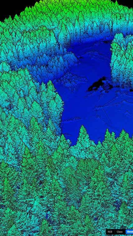
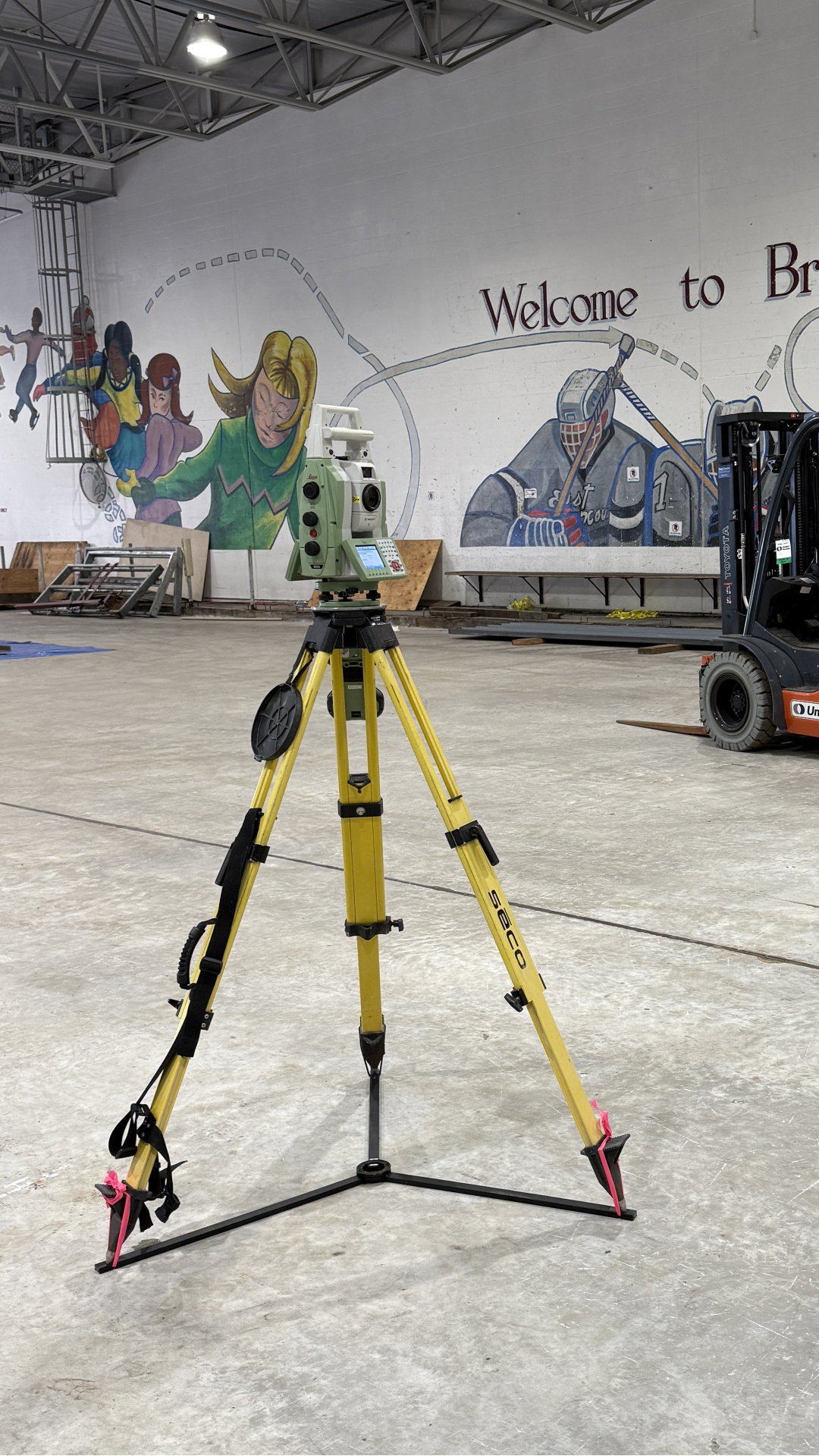
ADVANCED TECHNOLOGY
At 360 Surveys, we invest in the latest geospatial technology to deliver faster, more detailed, and more accurate survey data than traditional methods alone can provide. Our advanced technology services include UAV and drone mapping, mobile LiDAR scanning, and 3D laser scanning, giving us the ability to capture complex sites efficiently and with exceptional spatial detail. This capability allows us to tackle challenging environments, large project areas, and time-sensitive scopes with confidence.
Our technology services produce rich datasets including point clouds, orthophotos, digital elevation models, and 3D as-built models that integrate directly into your design and project management workflows. We are experienced in processing and delivering data in formats compatible with leading CAD, GIS, and BIM platforms. The result is higher-quality information, fewer site visits, and better decision-making across your project team.
360 Surveys is committed to staying at the forefront of survey technology so our clients always have access to the best tools available. We apply these capabilities not as a novelty, but as a practical means of delivering better outcomes on your project. Contact us today to learn how our advanced technology services can add value to your next scope of work.
CONSULTING
our consulting services provide the geospatial expertise and professional guidance that engineers, developers, municipalities, and legal professionals need to navigate complex project challenges. We draw on years of field experience and technical knowledge to offer practical, well-informed advice at any stage of a project. Whether you need support in the planning phase or independent analysis mid-project, our team is equipped to help.
Our consulting engagements cover a broad range of needs including feasibility assessments, survey strategy and planning, spatial data review, and expert witness support for legal proceedings. We work collaboratively with your team to understand the specific challenges you face and deliver clear, actionable recommendations. Our goal is to give you the confidence to make informed decisions backed by sound surveying expertise.
360 Surveys brings the professional credibility and depth of knowledge that demanding consulting assignments require. We are committed to providing objective, high-quality guidance that serves your project’s best interests. Get in touch today to discuss how our consulting services can support your team.