
You’re managing a construction project, but tracking progress feels like a constant battle. Delays creep in, mistakes go unnoticed, and unexpected costs pile up.
Or maybe you’re overseeing land development, trying to get accurate topographic data, but the traditional surveying methods are slow, expensive, and riddled with inaccuracies.
You need precise measurements and terrain analysis to make informed decisions, yet outdated tools keep holding you back.
Wouldn’t it be easier if you could get highly accurate site data in less time without the hassle of manual surveying? UAV photogrammetry Services are making that possible.
Infrastructure, environmental assessments, and commercial real estate are all benefiting from drone-based mapping. It provides faster insights, better accuracy, and significant cost savings.
So, which industries are experiencing the biggest transformation? And how survey companies redefining the way they operate? Let’s explore.
Construction – A Growing Industry That Needs Accuracy
The construction industry is one of the biggest in Canada, contributing billions of dollars to the economy and employing over 1.4 million people. From houses and office buildings to roads and bridges, construction projects are everywhere.
But with tight deadlines and rising costs, managing these projects is not easy. Even a small mistake in planning or surveying can lead to delays, wasted materials, and expensive fixes.
For years, construction teams have relied on manual ground surveys to measure land and plan projects. But these methods take too long, require a lot of labor, and can lead to errors.

UAV photogrammetry is making things easier. With high-resolution aerial mapping, construction managers get accurate site data in hours instead of weeks. They can track progress in real time, spot mistakes early, and keep projects on schedule.
Drones also help create 3D models and topographic maps, allowing builders to plan better and use materials efficiently. Most importantly, they improve safety by surveying hazardous areas without putting workers at risk.
Agriculture – Smarter Farming with Better Data
Agriculture is a key part of Canada’s economy, contributing billions of dollars annually. With vast farmland nationwide, farmers work hard to grow crops and raise livestock. But farming isn’t easy. Weather changes, soil conditions, and pest control challenges can affect production and profits.
Traditionally, farmers have relied on manual inspections to check their fields, but this takes time and doesn’t always catch problems early. By the time an issue is noticed, it may already be too late to fix.

UAV photogrammetry is making farming more efficient. Drones capture high-resolution images of fields in minutes, providing detailed information about plant health, soil conditions, and moisture levels. With this data, farmers can detect issues before they spread and take quick action to protect their crops.
Instead of guessing where to apply fertilizers or pesticides, farmers can target specific areas, reducing waste and lowering costs.
UAV mapping also helps with crop rotation planning by showing which parts of the land need extra care. With better insights, farmers are increasing yields, cutting unnecessary expenses, and making more sustainable choices for the future.
Mining – Safer and More Efficient Operations
Mining is a major industry in Canada, supplying essential materials for construction, technology, and manufacturing. It contributes billions to the economy and provides thousands of jobs. But mining is also one of the toughest industries to work in. Harsh environments, unpredictable terrain, and strict safety regulations make operations challenging.
Traditional surveying methods require workers to access dangerous areas to collect data, which takes time and increases the risk of accidents. Slow or inaccurate data can also lead to poor planning, wasted resources, and environmental damage.

UAV photogrammetry is improving mining operations by providing detailed topographic maps without the need for on-ground teams. With high-resolution aerial images, mining companies can assess layouts, measure stockpile volumes, and track land movements with precision. This reduces risks and improves decision-making.
Real-time drone data also helps mining engineers monitor environmental impact and stay compliant with regulations.
Real Estate – Aerial Views That Sell More Properties
In 2023, the Canadian real estate market was worth USD 302.4 million and is expected to reach USD 428.4 million by 2030.
Real estate is a major part of Canada’s economy, bringing in billions of dollars every year. Whether it’s homes, office buildings, or large developments, buying and selling property depends on strong marketing, good visuals, and accurate site evaluations.
As competition grows and demand rises, realtors, developers, and investors need better ways to showcase properties and make informed choices.

For years, real estate marketing has relied on regular photos and in-person visits to attract buyers. But standard ground-level images don’t always show the full property, and arranging visits for every potential buyer can take a lot of time.
For large developments, evaluating land and planning infrastructure can also be slow and expensive when done manually.
UAV photogrammetry is making real estate marketing more efficient. High-quality aerial images, 3D property scans, and virtual tours let buyers explore properties from every angle before visiting in person. This saves time for both realtors and clients, making sales smoother and faster.
For commercial real estate, UAV technology is even more valuable. Developers can use aerial mapping to analyze land, plan large projects, and give investors clear, visual insights. Instead of relying on blueprints and traditional surveys, decision-makers get a detailed, real-world view that helps bring properties to life.
Environmental Conservation – Protecting Ecosystems
Environmental conservation focuses on protecting nature, preserving wildlife, and keeping ecosystems healthy.
It is an important industry in Canada, with the environmental and clean technology sector employing over 314,000 people in 2021. This sector plays a key role in maintaining forests, wetlands, and oceans while ensuring that natural resources are used responsibly.
However, conservation efforts come with big challenges. Canada has vast wilderness areas, and monitoring them using traditional methods is difficult.
Researchers often have to travel to remote locations to collect data, which can take weeks or even months. Walking through forests, wetlands, or mountains to track land changes or wildlife populations is not only slow but also expensive.
In many cases, by the time problems like deforestation, illegal hunting, or pollution are discovered, the damage has already been done.

UAV photogrammetry is solving these problems by making it easier to gather important environmental data.
With drones, conservationists can get high-resolution aerial images of large areas in just hours, without disturbing the land or wildlife. These images help researchers see changes in forests, track endangered species, and detect illegal logging or hunting from a safe distance.
This technology is also helping with reforestation and land restoration projects. UAV-generated maps provide clear details about soil conditions, water sources, and terrain, allowing conservationists to choose the best spots for planting trees and restoring damaged areas.
With UAV photogrammetry, environmental professionals in Canada no longer have to rely on slow, outdated methods. They can now track changes in real-time, respond to threats faster, and make smarter choices to protect Canada’s natural landscapes for future generations.
Disaster Response – Faster Recovery with UAV Photogrammetry Services
Disaster response is all about helping communities recover from natural disasters like wildfires, floods, storms, and earthquakes. In Canada, where extreme weather and vast landscapes make disaster management challenging, responding quickly is crucial.
When disasters strike, emergency teams must act fast to assess damage, rescue people, and restore critical infrastructure. However, traditional disaster response methods have limitations.
Ground surveys take time and can be dangerous, especially when roads are blocked or buildings are unstable. Emergency teams often struggle to gather the information they need to send help to the right places. Delays in assessing the situation can slow down relief efforts, leaving communities vulnerable for longer than necessary.
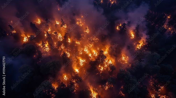
UAV photogrammetry is transforming disaster response by providing rapid aerial assessments. Drones can fly over disaster zones and capture high-resolution images, mapping the extent of the damage in just hours.
They help emergency teams identify blocked roads, locate survivors, and assess the condition of buildings—all without putting rescue workers in harm’s way.
This technology is also making rebuilding efforts more efficient. By using drone data, planners can determine which structures can be repaired and which need to be rebuilt from scratch.
Relief organizations and government agencies are now relying on UAV photogrammetry to speed up response times, distribute aid effectively, and support long-term recovery efforts.
As UAV photogrammetry becomes more common in disaster management, communities across Canada will be better prepared to recover from future emergencies.
What’s Next for UAV Photogrammetry Services?
More and more industries are using UAV photogrammetry Services every year. As drone technology gets better, businesses can expect even clearer images, smarter data analysis, and faster automation. These improvements will make aerial mapping quicker, more accurate, and more affordable.
From construction and real estate to disaster response and conservation, companies using UAV photogrammetry are working more efficiently and making better decisions.
Traditional surveying methods take too long and can’t always provide the level of detail needed. With drone technology, businesses get real-time data and high-precision maps that help them plan, track progress, and solve problems before they get bigger.
The question is—how long can companies afford to stick with outdated methods when UAV photogrammetry is already changing the way industries work?
The future of aerial mapping is here, and it’s making a real difference. If you want to take advantage of faster, more precise, and cost-effective surveying, 360Surveys is ready to help.