
Ever been on a construction site, struggling with old blueprints or ground reports that just don’t match up? You’re definitely not the only one. A lot of people in the field are now using drone surveying to make things quicker and more accurate. In fact, drone surveys can actually complete the job up to five times faster than traditional land-based methods. They also need fewer people and help reduce both time and costs.
But how do you actually get started with drone for surveying the right way?
Let’s break it all down by going over what tools you’ll need, which skills are important, the licenses you have to get, and some simple tips that will help you begin with confidence instead of confusion.
What Is Drone Surveying?
Drone surveying involves using unmanned aerial vehicles (UAVs) to capture aerial data of land areas. These drones are equipped with cameras or sensors that collect information, which is then processed to create maps, models, or measurements of the surveyed area.
Traditional surveying methods can be time-consuming and labor-intensive. Drones offer a faster, safer, and often more cost-effective alternative. They can access hard-to-reach areas and provide high-resolution data, making them invaluable for various industries.

Getting Started with Drones for Surveying
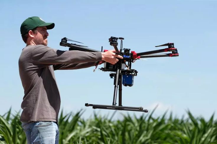
Before anything takes off, you need the right equipment, and that starts with choosing a drone that matches the kind of work you plan to do.
Choosing the Right Drone for the Job
Understand Your Surveying Requirements
Begin by clearly defining the scope and nature of your surveying projects. Are you mapping vast agricultural fields, inspecting urban infrastructure, or conducting environmental assessments? The specific requirements of your projects will influence the type of drone that best suits your needs.
Consider the Terrain and Environment
The physical characteristics of the survey area play a significant role in drone selection. For instance, densely forested or mountainous regions may require drones with advanced obstacle avoidance systems and robust flight stability. In contrast, open and flat terrains might allow for simpler drone models.
Evaluate Flight Time and Range
Longer flight times and extended range capabilities are essential for covering large areas without frequent battery changes. Assess the average size of your survey sites to determine the necessary flight endurance and range.
Assess Camera Quality and Sensor Type
High-resolution cameras are crucial for capturing detailed imagery. Consider drones equipped with cameras that have large sensors and support for RAW image formats, as these features enhance image clarity and provide greater flexibility during post-processing.
Examine Data Accuracy and Positioning Systems
Precision is paramount in property surveying. Drones with Real-Time Kinematic (RTK) or Post-Processed Kinematic (PPK) systems offer enhanced positional accuracy, reducing the need for extensive ground control points. Evaluate whether your projects demand such high levels of accuracy.
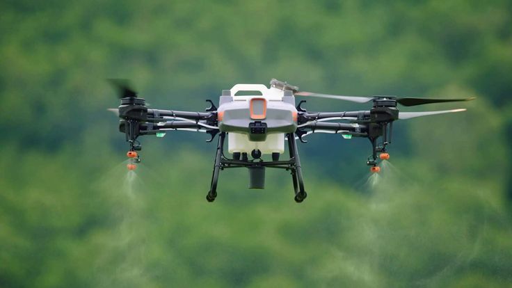
Review Payload Capacity and Modularity
Depending on your surveying needs, you might require drones capable of carrying additional sensors, such as LiDAR or multispectral cameras. Ensure the drone has adequate payload capacity and modularity to accommodate these tools.
Analyze Software Compatibility
The drone should be compatible with your preferred flight planning and data processing software. Seamless integration between hardware and software streamlines operations and enhances data analysis efficiency.
Factor in Budget and Total Cost of Ownership
While initial purchase price is important, consider the total cost of ownership, including maintenance, software subscriptions, and potential upgrades. Investing in a drone that meets your long-term needs can be more cost-effective than opting for a cheaper model that requires frequent replacements or lacks necessary features.
Check Regulatory Compliance
Ensure the drone complies with local aviation regulations, including weight restrictions, operational limitations, and licensing requirements. Compliance not only ensures legal operation but also promotes safety and reliability in your surveying activities.
Understanding Regulations
Before flying, familiarize yourself with local aviation laws. In Canada, for example, drones over 250g must be registered, and pilots need a basic or advanced license from Transport Canada. Always check your local rules before taking off.
Training and Certification
While drones are user-friendly, proper training ensures safety and data accuracy. Consider enrolling in a drone piloting course to learn about flight operations, data collection, and emergency procedures.
Know the Rules Before You Fly
Learn the Local Laws
In Canada, the U.S. rules change by region. You might need to pass an online test, register your drone, or get special airspace permission.
Never assume it’s okay to just launch your drone. Know the rules. Check with your national aviation authority before your first flight.
Insurance Is Not Optional
Drone crashes can happen, even to pros. Liability insurance protects you if something goes wrong. It also gives clients confidence you’re serious.
Planning Your First Drone Surveying
Scout the Site First
Before you send your drone up, take a walk. Spot any trees, towers, power lines, or obstacles. Figure out your takeoff and landing area. It doesn’t need to be perfect, just safe.
Plan Your Flight Path
Use drone mapping software to create a grid flight path. These tools help you automate your flight, so the drone flies a precise route with consistent overlap. That consistency makes your data more useful.
Check the Weather
Avoid strong winds, rain, or extreme heat. A small weather delay is better than losing a drone, or ending up with junk data.
What to Do Step-by-Step On Flight Day
Pre-Flight Checklist
Before you launch, double-check your batteries, memory card, and firmware. Calibrate your compass and ensure the GPS signal is strong. It’s not exciting, but skipping this stuff causes most avoidable issues.
Monitor Your Flight
Stay focused during flight. Watch the drone, monitor the app, and be ready to step in if something goes wrong. Don’t walk away or assume automation has everything under control.
After Landing, Review the Data
Don’t pack up immediately. Take a few minutes to preview your photos or videos. If you missed a spot or something looks off, now’s your chance to fix it.
Processing Data Into Useful Results
Import Your Data into Mapping Software
Tools like DroneDeploy, Pix4D, or Agisoft Metashape turn raw photos into usable outputs. That might be a 2D orthomosaic, a 3D model, or a topographic map. The software does the heavy lifting, but the more consistent your input, the better your output.
Watch Out for Gaps
Missing data usually means poor overlap, flight errors, or low lighting. If something looks weird, like warped lines or missing corners, you might need to re-fly the site.
Export for Your Audience
Different teams want different formats. Engineers might want DWG files. A client may prefer a visual PDF report. Choose formats that speak their language.
Avoiding Common Beginner Drones for Surveying Mistakes
Buying Before Researching
Not all drones are good for surveying. Do your homework before dropping cash. One-size-fits-all rarely works.
Skipping Practice Flights
Don’t make your first real job your first-ever flight. Practice in a wide-open space. Learn to control your drone like it’s second nature.
Ignoring Permissions
If you’re flying in urban areas, near airports, or above people, you probably need extra approvals. Don’t learn this the hard way with a fine or complaint.
Skills That Make a Difference
Learn Some Basic Mapping
You don’t need to be a surveyor, but knowing what orthomosaics, DSMs, and GCPs are will help. There are great free tutorials online to get you started.
Understand Photography Fundamentals
Lighting, shutter speed, and ISO all affect image quality. Better images mean better maps. Learn how to use manual camera settings.
Keep Improving
Drone tech changes fast. Stay sharp. Attend webinars. Follow drone mapping blogs. Ask questions in forums. You’ll level up faster than you think.
Conclusion
Getting started with drones for surveying doesn’t mean buying the most expensive gear or becoming a full-blown mapping expert. It means starting smart. Know what you’re surveying. Use the right tools. Plan your flights carefully. And never stop learning.
Sometimes, it makes more sense to hire a trusted drone surveying company, especially when precision is critical or you’re under a deadline. That’s where 360 Land Surveying comes in. Our experienced team handles complex drone mapping projects so you don’t have to figure it all out from scratch. It’s an easy way to get reliable results without the stress.