
In the field of surveying and mapping, technology has continually changed the way things are done. One major breakthrough is LiDAR (Light Detection and Ranging) technology, which has greatly improved the accuracy and speed of land surveys.
However, traditional surveying techniques still have their advantages and are widely relied on for many projects. This article examines the key differences between LiDAR services and traditional methods, enabling you to determine which option best suits your needs.
Understanding LiDAR Technology
Lidar works by using laser pulses to measure the distance between a sensor and a target. It emits quick laser beams that bounce off objects in the surroundings. The system calculates how long it takes for the laser to return, converting this information into accurate distance measurements.
When combined with GPS and inertial measurement systems, LiDAR produces detailed 3D maps and models of the surveyed area. It can be mounted on drones, airplanes, or ground vehicles, making it a flexible tool for various terrains and purposes.
Key Features of LiDAR Technology:
High Accuracy
LiDAR provides highly detailed data with precision, often measured in centimetres. In comparison, traditional surveying methods, such as those using total stations, can achieve similar levels of accuracy but typically require significantly more time and manual labour to gather data over large areas.
Speed
Lidar systems can cover large areas in a short time, significantly reducing project timelines.
Versatility
Lidar can be used for diverse projects, including urban planning, forestry management, and infrastructure development.
Data Density
Lidar generates millions of data points, providing a comprehensive view of the surveyed area.
Remote Sensing
It can capture data from difficult-to-access or hazardous areas without putting personnel at risk.
Traditional Surveying Methods
Traditional surveying utilizes tools such as total stations, theodolites, levels, and GPS devices to measure distances, angles, and elevations.
For instance, boundary surveys for residential properties often depend on these methods to ensure accurate land boundaries and compliance with legal standards. These techniques have been the foundation of surveying for centuries and continue to be valuable because of their proven reliability and precision.

Key Features of Traditional Surveying:
- Established Techniques: Methods like triangulation and levelling have been refined over decades, offering consistent results.
- High Precision: When conducted meticulously, traditional surveying can achieve accuracy comparable to Lidar in certain contexts.
- Cost-Effective for Small Areas: For smaller-scale projects, traditional methods can be more affordable.
- Familiarity: Many professionals are well-versed in traditional techniques, reducing the learning curve.
- Manual Verification: Surveyors often perform manual checks, ensuring accuracy in specific critical areas.
Comparing LiDAR Services and Traditional Surveying Methods
Let’s break down the comparison into several crucial factors:
Cost
Lidar systems come with high upfront costs for setup and equipment. However, their speed in collecting data often balances out these costs on large-scale projects, making them a cost-effective option over time.
In contrast, traditional surveying is usually more budget-friendly for smaller projects. Yet, the amount of manual work involved can drive up costs when dealing with larger areas.
Terrain and accessibility
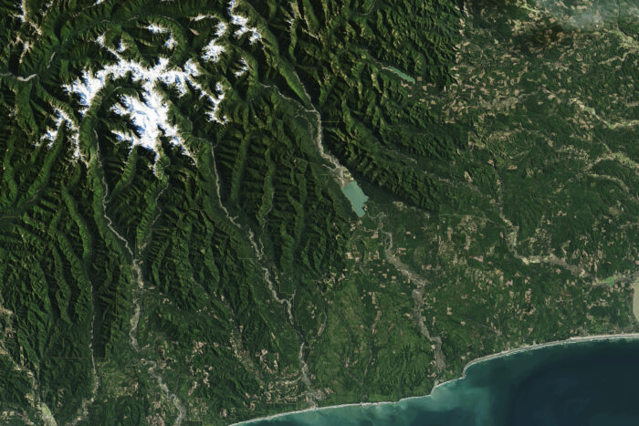
Lidar is highly effective in difficult terrains like dense forests, steep mountains, or rugged landscapes, where manual surveying can be hard or unsafe. Since Lidar can work from aerial or remote platforms, it is a practical solution for these environments.
On the other hand, traditional surveying depends on physical access to the area, which can be challenging and risky in remote or dangerous locations.
Accuracy and Precision
Lidar offers centimeter-level accuracy by creating dense point clouds, making it an excellent choice for detailed 3D modeling and analysis. Traditional surveying methods can also achieve similar accuracy, but they usually take much more time and effort, especially when collecting data for large-scale projects.
Efficiency
Lidar is much faster than traditional methods, covering large areas in a small amount of time. This speed is especially useful in challenging terrains where manual measurements would take far longer. In contrast, traditional surveying takes more time because data is gathered point by point, requiring a lot of manual effort.
Data Output
Lidar creates detailed 3D models and datasets, making it possible to visualize and analyze data in advanced ways. This makes it perfect for tasks that need high-resolution, multidimensional information. In contrast, traditional surveying usually produces 2D maps and measurements, which might need extra interpretation or processing to handle more complex analyses.
Low Environmental Impact of LiDAR Services
Lidar is low-impact because it can be operated from aerial platforms, which means it doesn’t need to touch the ground.
This makes it a good choice for areas that are ecologically sensitive. In comparison, traditional surveying often requires activities on the ground, which can disturb local ecosystems or temporarily change the landscape.
Use Cases
LiDAR Services by 360 Land Surveying are especially useful for tasks like urban planning, infrastructure monitoring, forest management, flood modeling, and archaeological research. Its ability to create detailed models makes it ideal for these areas.
On the other hand, traditional surveying is a trusted method for tasks such as boundary surveys, construction staking, and other projects that need close human supervision and high precision.
| Advantages of Lidar Services | Advantages of Traditional Surveying |
| Time-Saving: Lidar can survey large areas quickly, saving hours compared to traditional methods. | Cost-Effective for Small Projects: Traditional surveying is more affordable for smaller operations. |
| Rich Data: Lidar produces detailed point clouds, useful for accurate analysis and modeling. | Localized Expertise: Surveyors can provide tailored solutions based on specific site conditions. |
| Safety: Lidar reduces the need for surveyors to work in dangerous or hard-to-reach areas. | Fewer Technical Dependencies: Traditional surveying doesn’t require specialized software or extensive training. |
| Flexibility: Lidar can work both day and night without needing natural light, offering flexibility. | Proven Reliability: Traditional methods have been tested over time and deliver consistent, trusted results. |
| Integration: Lidar data can easily integrate with GIS systems and CAD software for advanced modeling. | Hands-On Approach: Traditional surveying allows for more direct interaction with the site and precise measurements. |
Choosing the Right Approach for Your Project
When deciding between Lidar services and traditional surveying, consider the following factors:
Project Scale
Lidar is more efficient for large projects because it can gather a lot of data quickly. For smaller projects, traditional methods might work better since they’re simpler and less costly.
Budget
Traditional methods are usually cheaper for smaller and simpler projects. However, if you’re working on a bigger or more complex project, Lidar can be more cost-effective in the long run because of the high-quality data it provides.
Terrain
Lidar is especially helpful for projects in difficult or hard-to-reach areas like dense forests, mountains, or other challenging terrains. In these places, traditional methods might not work as well or might take much longer.
Data Requirements
If your project needs very detailed maps or 3D models, Lidar is the best option. It collects highly accurate topographic data and can create precise, detailed models of the land.
Timeline
When you’re working with tight deadlines, Lidar can help you collect a lot of data quickly. It’s a faster method compared to traditional surveying, which can be slow and time-consuming.
Expertise Available
Lidar requires specialized knowledge and equipment; therefore, if your team lacks experience with it, traditional methods might be a better fit. But if you’re willing to train or hire experts, Lidar can be a powerful tool for your project.
Future Trends
As technology continues to improve, the gap between LiDAR and traditional surveying is becoming smaller. Many projects now employ a combination of both methods, integrating Lidar data with on-the-ground measurements. This hybrid approach is becoming more common because it offers the best of both worlds.
At the same time, the cost of Lidar systems is decreasing, making them more accessible for a broader range of projects and businesses.
Advances in machine learning and artificial intelligence (AI) are enabling the more effective processing and interpretation of data from both Lidar and traditional surveying methods. These technologies enable better decision-making and more accurate predictions, making the overall process more innovative and reliable.
Conclusion
Both LiDAR Services and traditional surveying methods have their advantages and limitations. Lidar is known for its ability to quickly create detailed 3D models of large areas, making it ideal for big or complex projects. Traditional surveying, on the other hand, is better suited for smaller projects that require precise measurements of a small area, and it tends to be more cost-effective.
Lidar is fast, accurate, and flexible, making it the ideal choice for large-scale or challenging projects. Meanwhile, traditional surveying remains a dependable and budget-friendly option for tasks that are more localized and simpler in scope.
Ultimately, choosing between these methods depends on what your project requires, the budget you have available, and your specific objectives. By understanding the strengths and limitations of both options, you can make a smart choice that will help your surveying project succeed.