
Pros and Cons of Using UAVs for Topographic Surveys
June 4, 2025 4:48 pm Leave your thoughtsUnmanned Aerial Vehicles (UAVs), or drones, have become a powerful tool in the surveying and mapping industry. What once required... View Article
Unmanned Aerial Vehicles (UAVs), or drones, have become a powerful tool in the surveying and mapping industry. What once required... View Article

When navigating the home-buying process, understanding the distinct roles of property surveys and home inspections is crucial. Surprisingly, only about... View Article

Ever been on a construction site, struggling with old blueprints or ground reports that just don’t match up? You’re definitely... View Article

You’re ready to buy property in Canada. Everything looks great, and then your realtor says, “We need a survey.” Suddenly,... View Article

Have you ever wondered how drones can create incredibly accurate 3D maps of landscapes, forests, or construction sites down to... View Article

You’re managing a construction project, but tracking progress feels like a constant battle. Delays creep in, mistakes go unnoticed, and... View Article
Buying, selling, or developing land comes with a lot of requirements. Sometimes, your neighbor’s fence is on your property, or... View Article

What if inspecting a massive construction site or checking for damage after a disaster took hours or even days? Traditional... View Article

In the field of surveying and mapping, technology has continually changed the way things are done. One major breakthrough is... View Article
Picture this: you’re trying to plan a new neighborhood or improve an existing city area, but you’re stuck dealing... View Article

UAV photogrammetry is a way to use drones to take detailed pictures from above, and it’s making construction site surveys... View Article

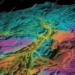
Topographical surveying has come a long way, and LiDAR (Light Detection and Ranging) is quickly becoming a trend revolutionizer. This... View Article